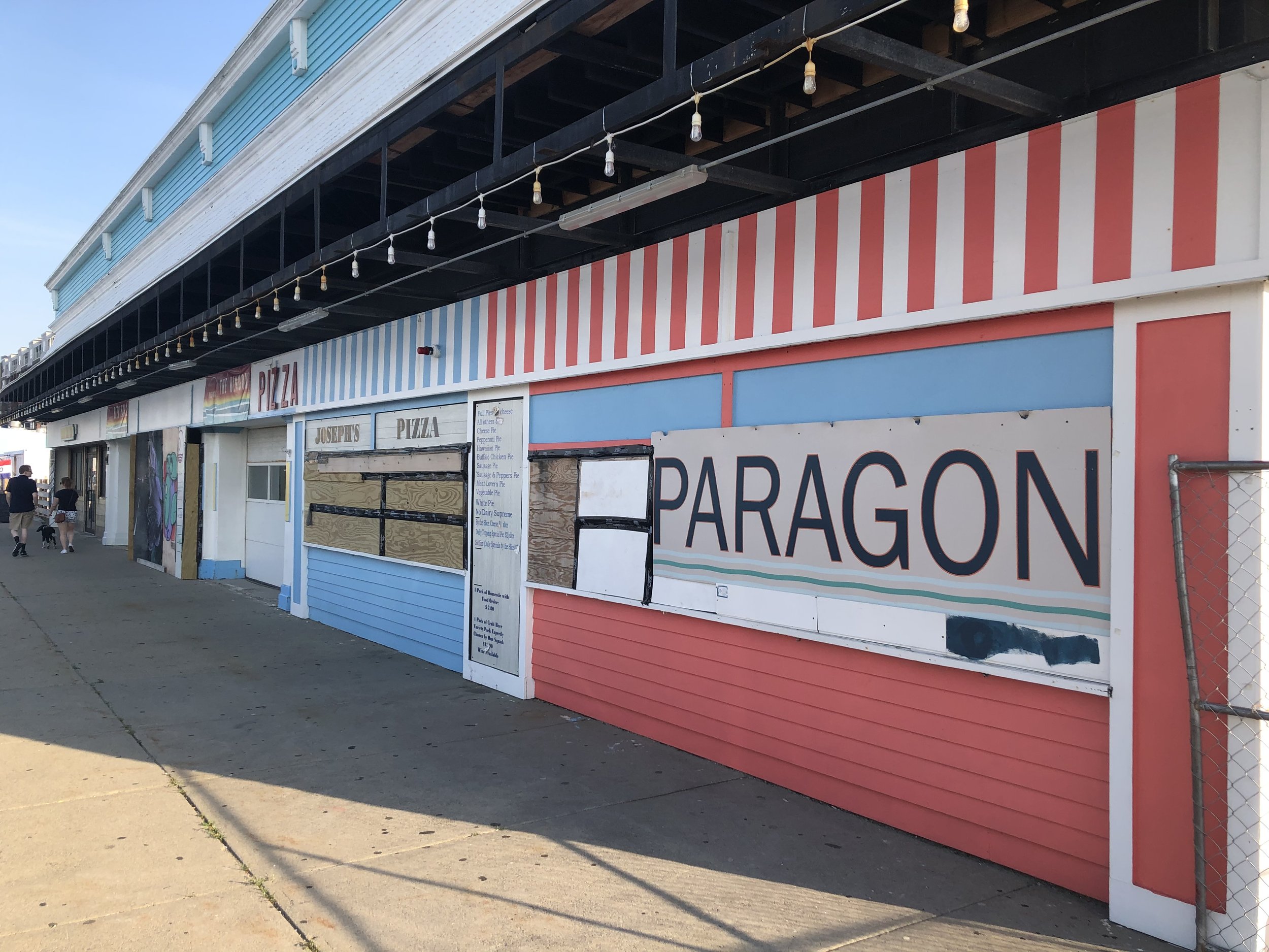
Paragon Dunes developer withdraws from environmental review, to revise flood control plan
/By Dolores Sauca Lorusso
The developer proposing the Paragon Dunes mixed-use project has withdrawn from a state environmental review process and will resubmit its Environmental Notification Form to address flood resiliency concerns.
In a June 3 letter to the Massachusetts Environmental Policy Act Office, The Procopio Companies Vice President of Development David Roache said the company sought withdrawal to address the issues raised by state officials.
“Given the narrow scope of the comments received from state agencies, we feel the best course of action is to resubmit a revised ENF,” said Roache, who also acknowledged comments from planning board members and the public that the MEPA review had not been adequately advertised.
“While the submission followed all regulations, restarting the process will allow additional time for review to avoid any perception that the review process was rushed,” he wrote to MEPA Environmental Analyst Eva Vaughan.
Click here to read the full Environmental Notification Form
Click here to read the comments by various state agencies
Click here to read Procopio’s letter of withdrawal from June 3, 2024
The proposed development will include 132 residential units, commercial uses, an elevated courtyard with an inground pool, public open spaces, landscaping, a stormwater treatment system, a parking garage and surface parking for a total of 180 cars. As presented in the ENF, the new structure will have four stories, including three stories of residential units above first-floor commercial space. The garage level, located partially below the street grade of Nantasket Avenue, will consist of parking and storage areas for residents, as well as an enclosed trash room and utility spaces.
Two months after receiving planning board approval of its special permit, on May 20 Procopio finalized the purchase of the property for $6 million from Nantasket Dune Holdings LLC. The seasonal businesses that previously operated there, including the Paragon Boardwalk, arcade, ice cream stand, and miniature golf course, are not scheduled to reopen this summer.
Construction on the site cannot begin until the environmental review is completed and all building permits are issued.
During the MEPA review by several state agencies, some analyses requested include grading plans with cross-sections that show the existing and proposed grades, as well as the Federal Emergency Management Agency (FEMA) flood zone elevations; evaluation of how these grade changes will affect the flow of coastal floodwaters; studies adequately characterizing how high groundwater conditions at the site will impact the viability of the proposed infiltration system.
The Department of Conservation and Recreation said a Construction and Access Permit (CAP) will be required for work activities within the boundaries of the DCR’s property
“Additional details regarding the velocity and volume of overtopping flood waters entering the site are necessary to assess potential negative impacts, to properties under the care and control of DCR, resulting from diversion of flood flows and reflection of wave energy onto Nantasket Ave., the comfort station site, and the parking lot adjacent to the beach,” the agency wrote in its comments.
The Dunes project would connect into existing stormwater systems that serve DCR’s parking lot on George Washington Boulevard, or would access discharge locations by crossing DCR property. The DCR pointed out more information is needed to assess the potential impacts to these systems.
The DCR requires proof that the project will have no negative impacts to DCR’s stormwater infrastructure, its function, and the Weir River Area of Critical Environmental Concern, while the Department of Environmental Protection (DEP) advised a full technical review for compliance with Chapter 91 waterways regulations.
Coastal Zone Management Director Alison Brizius wrote that FEMA flood maps predict that in a major storm, there will be three feet of overwash, with waves coming over the seawall along Nantasket Beach and moving across the project site.
“The proposed buildings and vertical walls at grade could channelize floodwater through smaller areas, increasing the velocity and volume of floodwaters, likely increasing storm damage to landward infrastructure, including the DCR parking area and George Washington Boulevard,” according to CZM. “Since Nantasket Avenue and George Washington Boulevard are the only two roads in and out of Hull, it is important that alternative designs be considered for this development to minimize the potential to cause damage to these evacuation routes.”
According to CZM, the geotechnical boring analyses conducted on the site confirm the location meets the definition of a coastal dune and should be delineated as such on the project plans.
The CZM noted the coastal dune functions on the project site are limited due to past development.
FEMA has determined through post-storm assessments as well as laboratory analyses that buildings built at grade with solid walls in Coastal A Zones, such as this project, are subject to structural damage. As a result, FEMA recommended in its 2011 Coastal Construction Manual that buildings in Coastal A Zones be built to Velocity Zone Standards, such as on open pilings.
“Although this code is not in effect yet, elevating new buildings in Coastal A Zones on open pilings is a best practice and should be further evaluated for this site,” according to the CZM letter.
The review of the Paragon Dunes project was continued to the Tuesday June 11 meeting of the Hull Conservation Commission; it is not clear whether the ENF withdrawal will affect this timetable.
Like what you’re reading? Stay informed with a Hull Times subscription by clicking here.
Do you have an opinion to share? Click here to write a Letter to the Editor.


